Island Hopping Adventure!

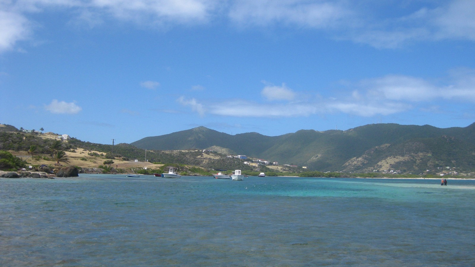
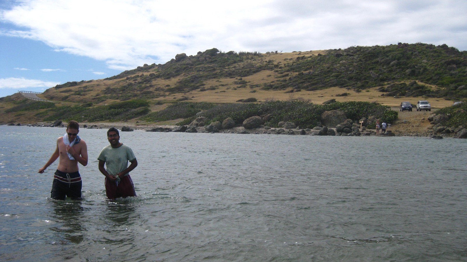
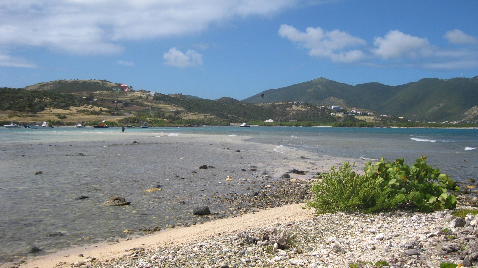
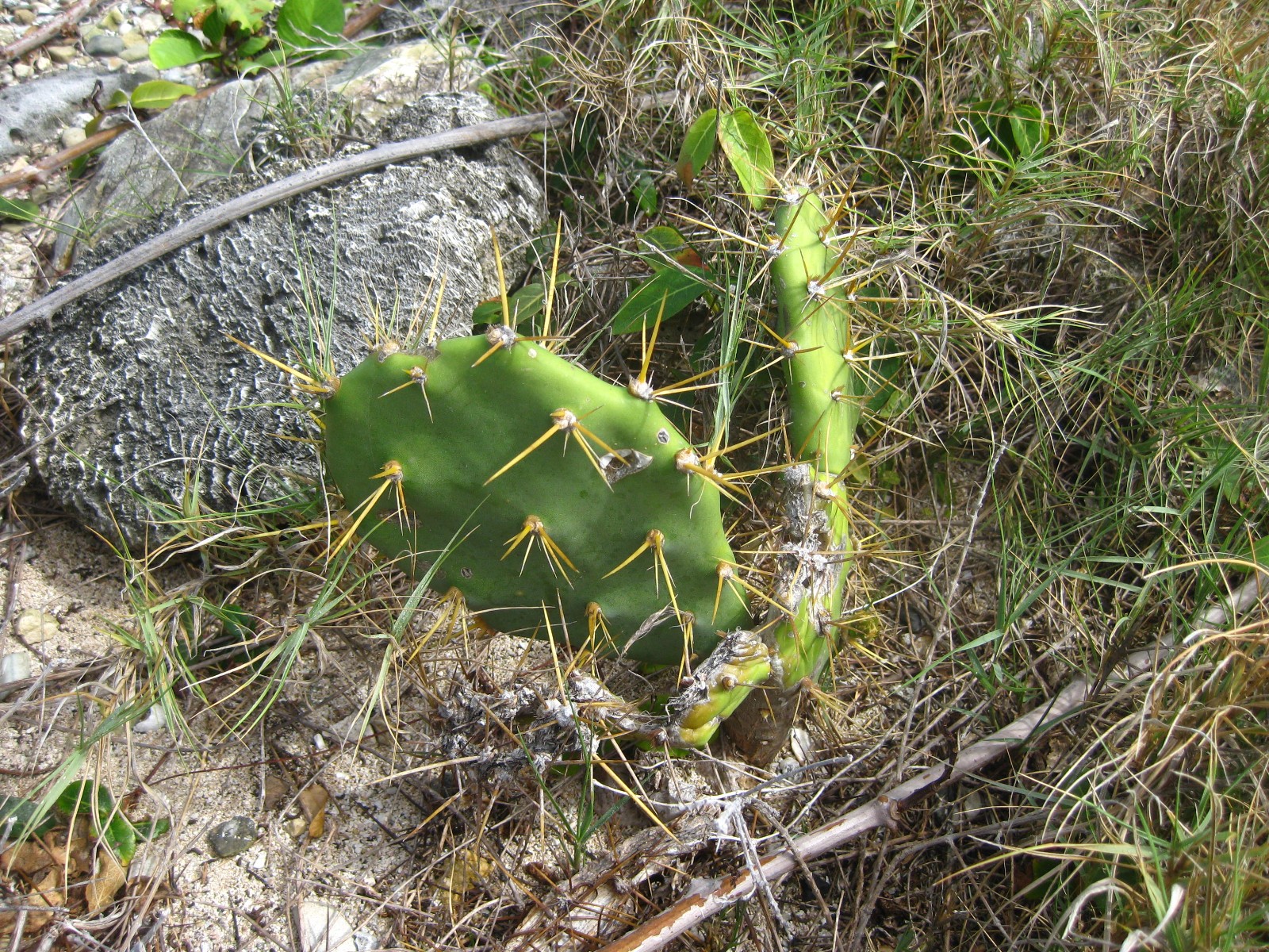
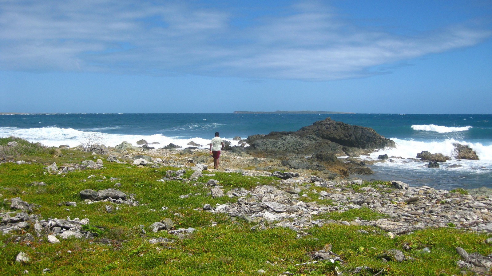
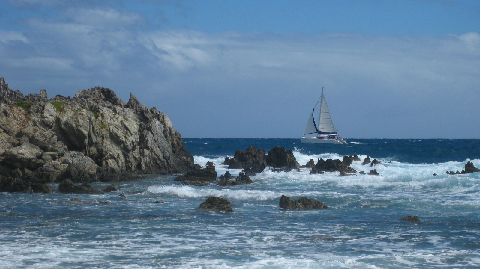
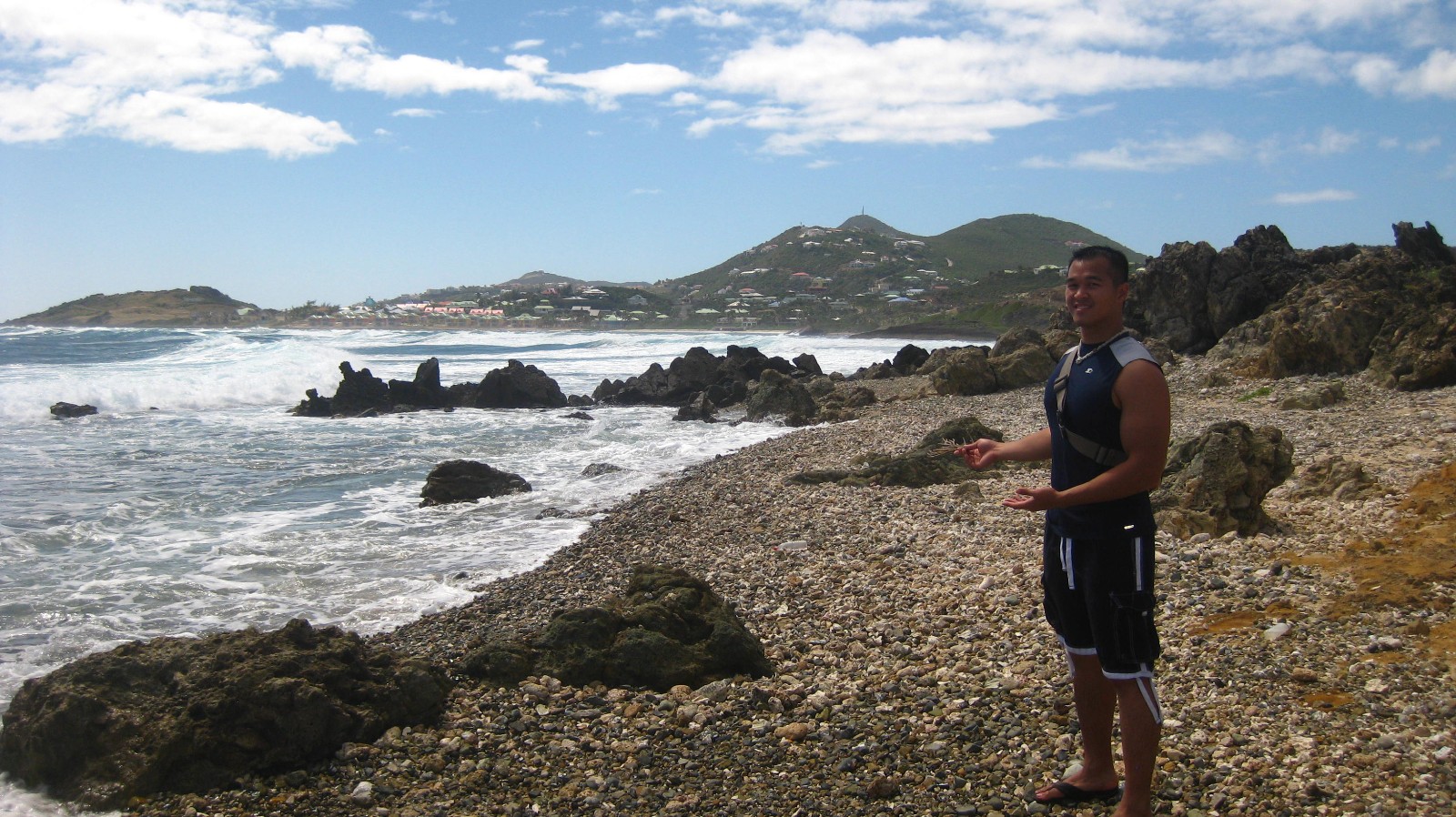
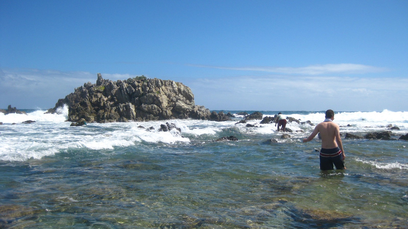
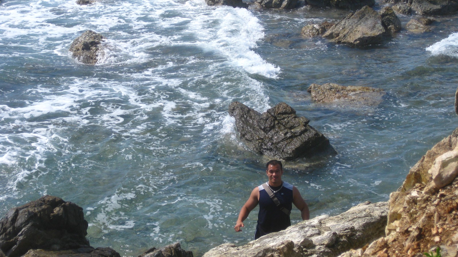
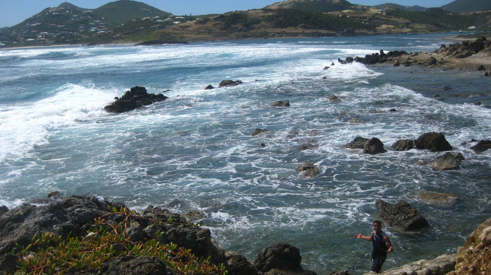
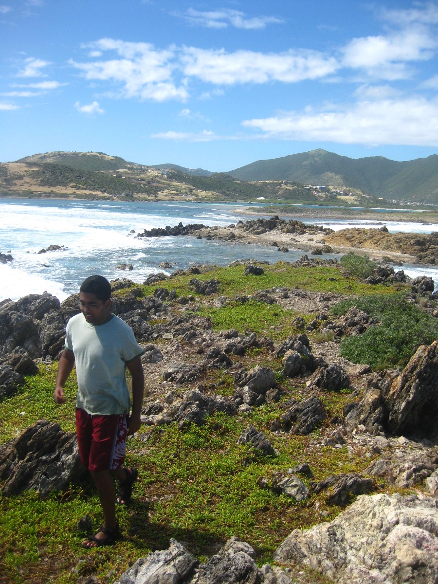
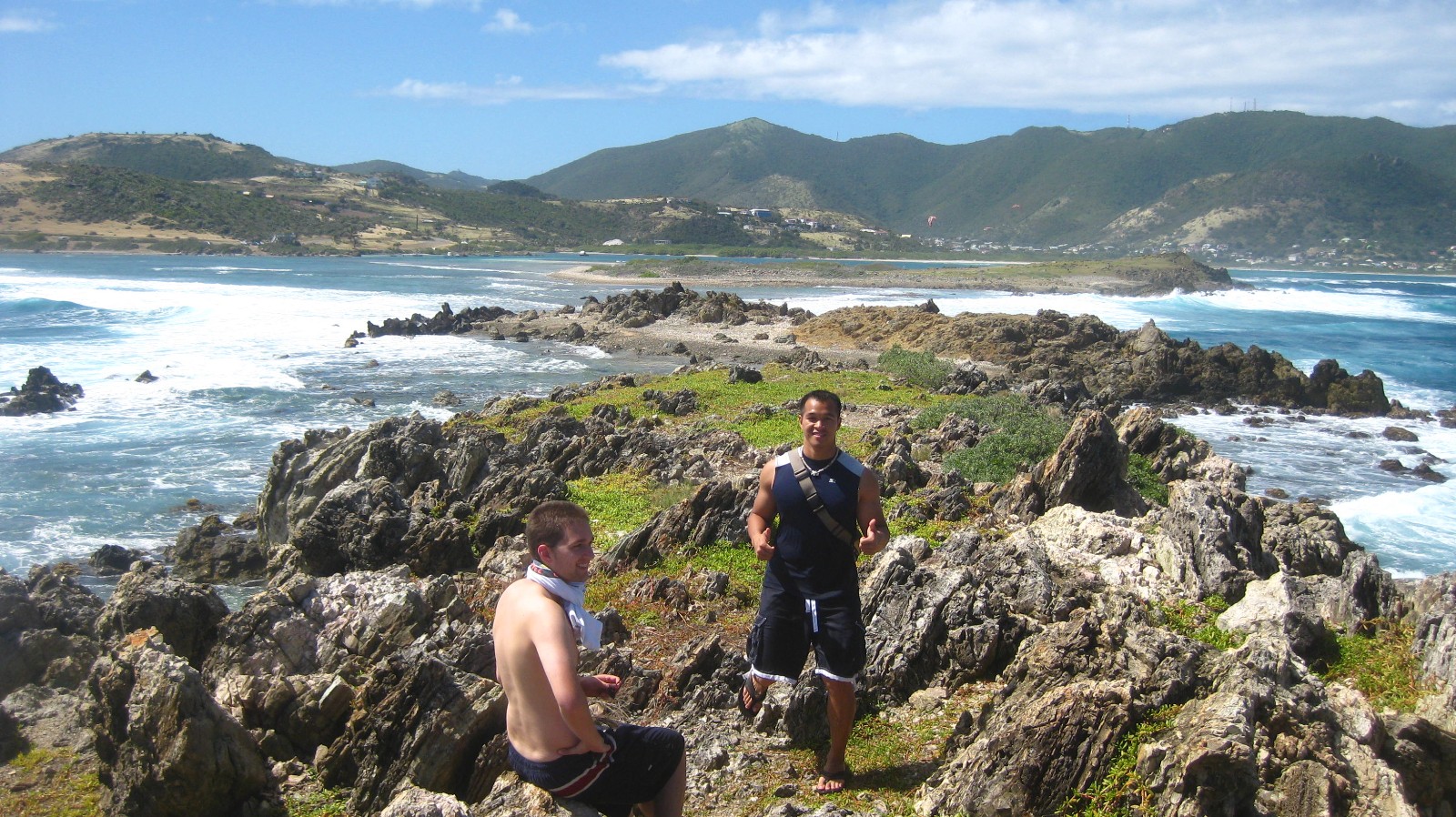
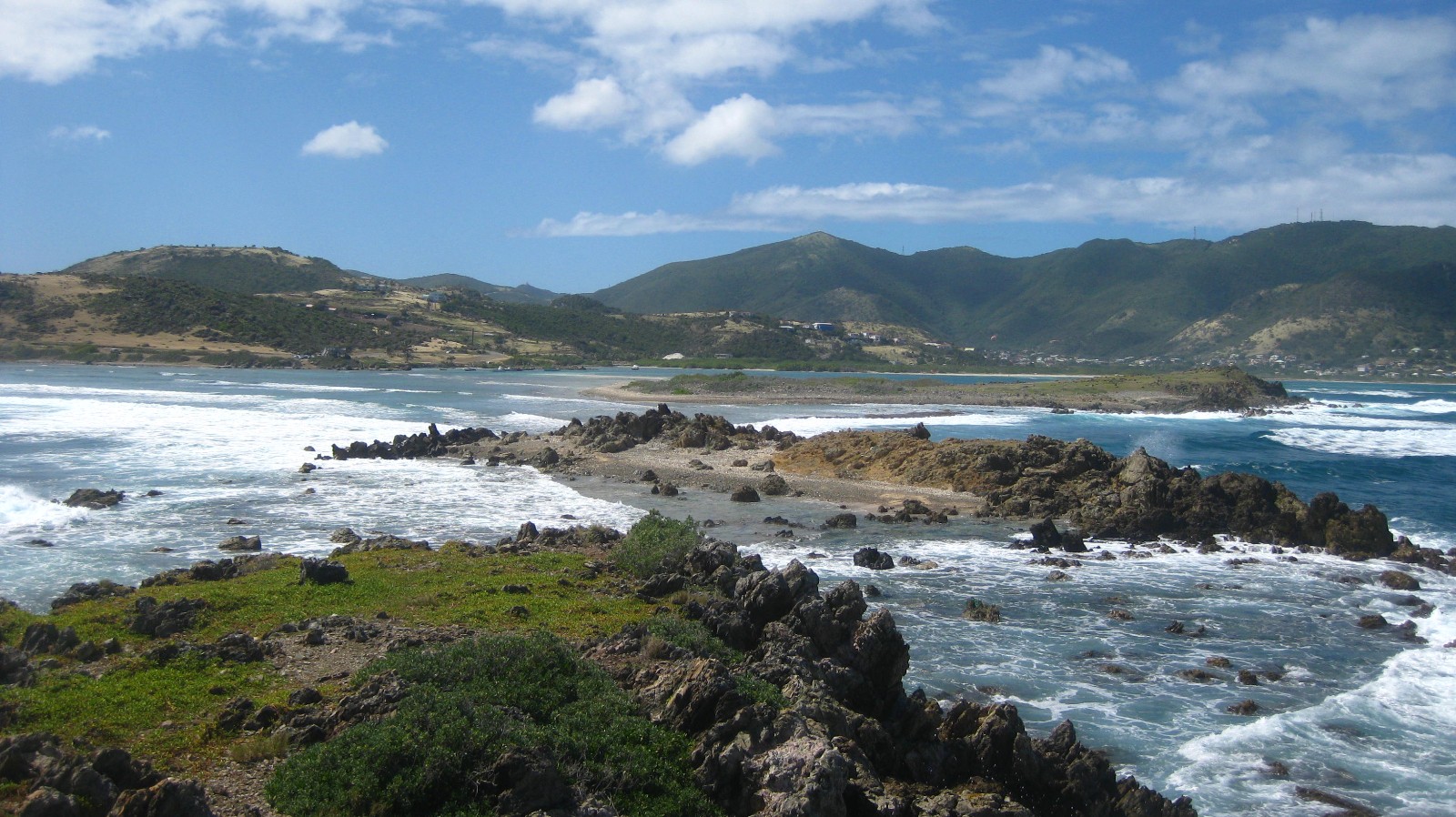
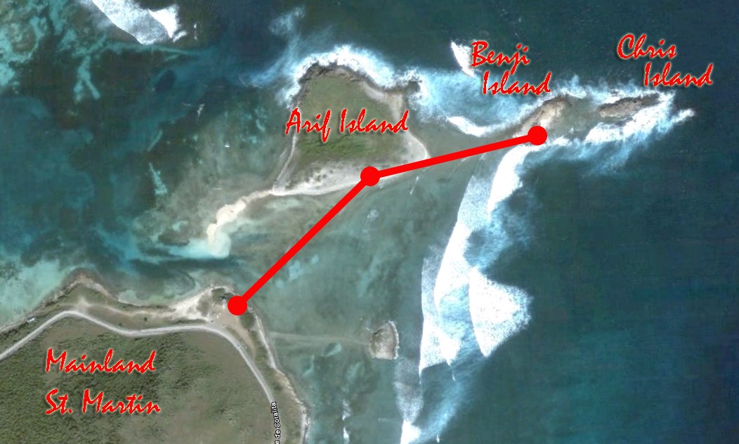
Last Sunday, Chris, Arif, and I took our first post-block trip of the semester. Our mission this time: to conquer the uncharted islands off the eastern coast of St. Martin. Our journey started on the west coast where we stay. We hopped into a car and drove half an hour east, crossing into French territory to Lucas Bay, away from the tourist crowd. It was quite a windy day and a few dozen kite surfers were out catching the trade winds over the water. Not too far off across the sound, an island rose out from below. It was shrubby, rocky, and deserted, and the only way to get there was to walk across the water. We had no idea what was there, nor what the locals called it. We did not know how deep the water would get, but we knew we wanted to find out. With our sandals on our feet, we stepped into the water, on seaweed, rocks, and sea urchins abound. The walk to the first island was pretty easy. The water was shallow, about knee-deep most of the way, and almost to the waist at the deepest. We stepped on shore. The island was a collection of dead coral, conch shells that have lost their glimmer, and other ancient organic depositions of calcium carbonate. But from this graveyard sprouted new life, with shrubs, grass, and cacti dotting the flat terrain of the island. As we stood over the bluff at the far end of the island, the waves below hit mercilessly against the rocks below our feet, but we were immune from their blows. We have conquered the first island. The second island was a little bit rougher to get to. As we walked across the submerged pathway, waves of opposing currents rolled in from both sides and we were in the middle of their clash. “Do these waves behave more like EPSPs or Action Potentials?” I joked around to Arif right in front of me. “Their peaks add up so they’re more like EPSPs” he responded. He was right.

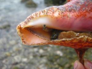
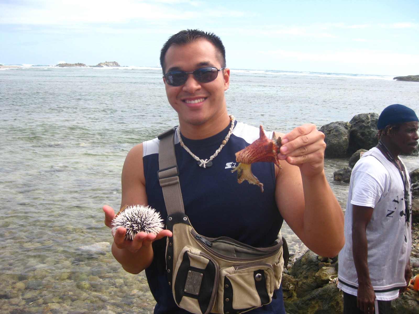
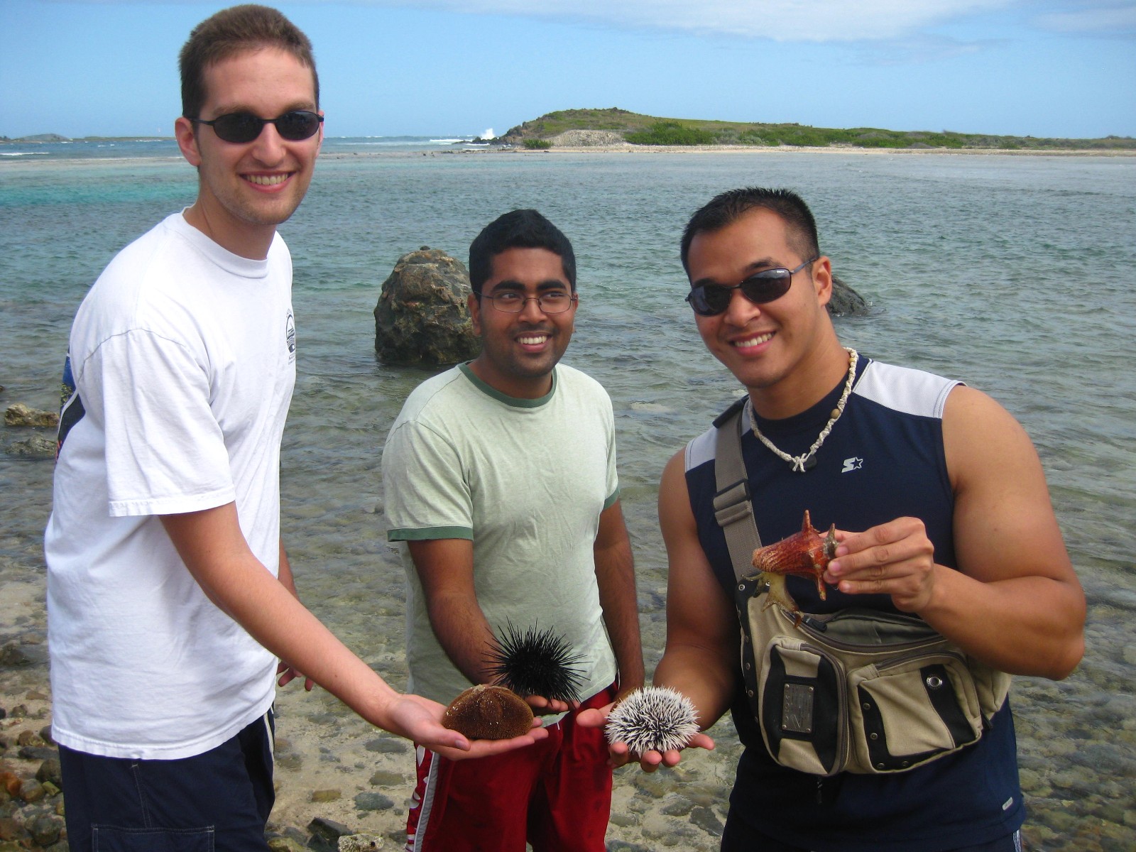
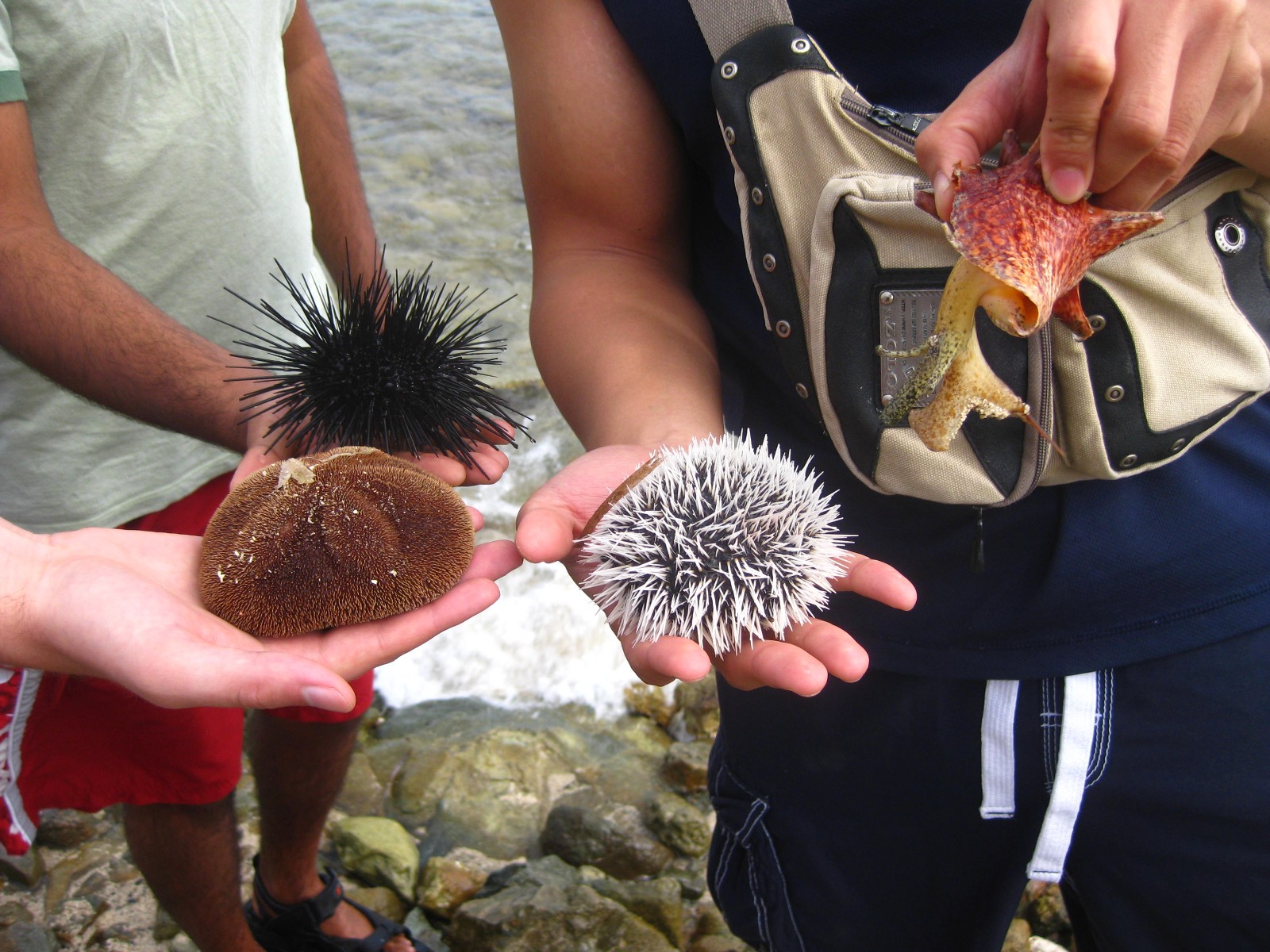
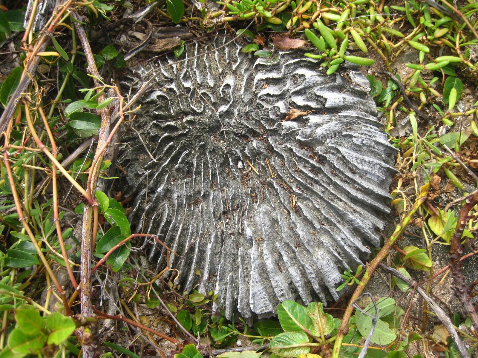
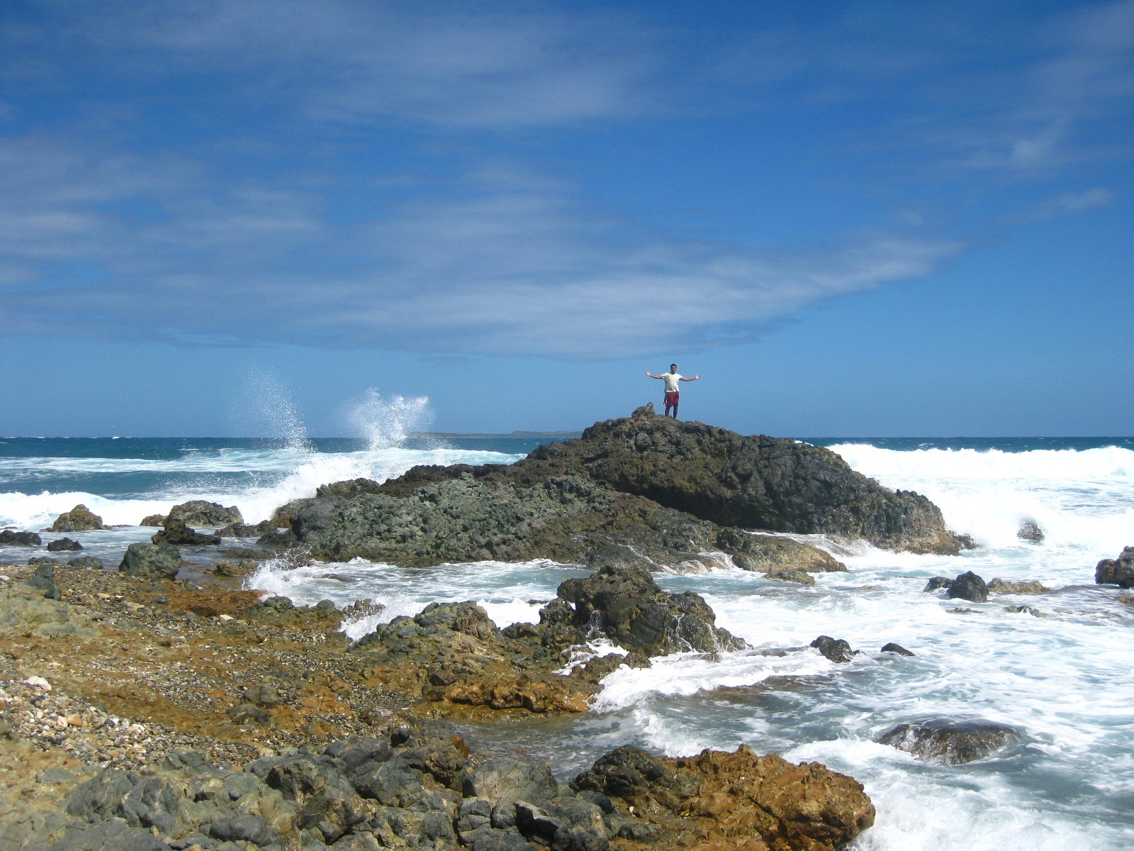
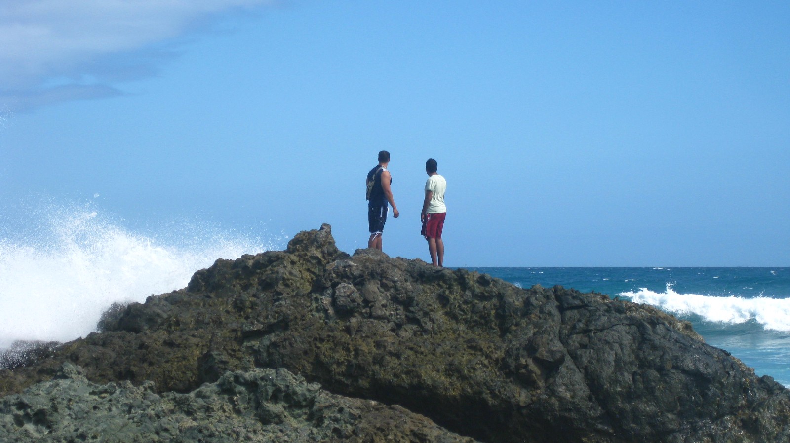
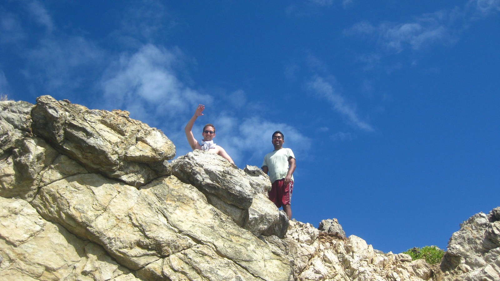
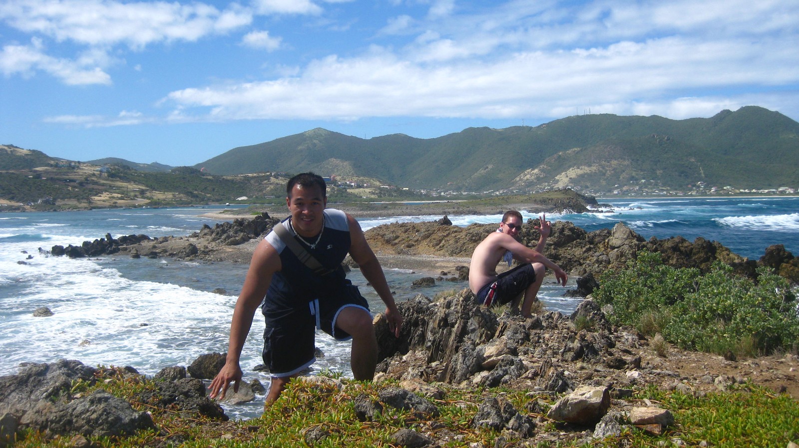
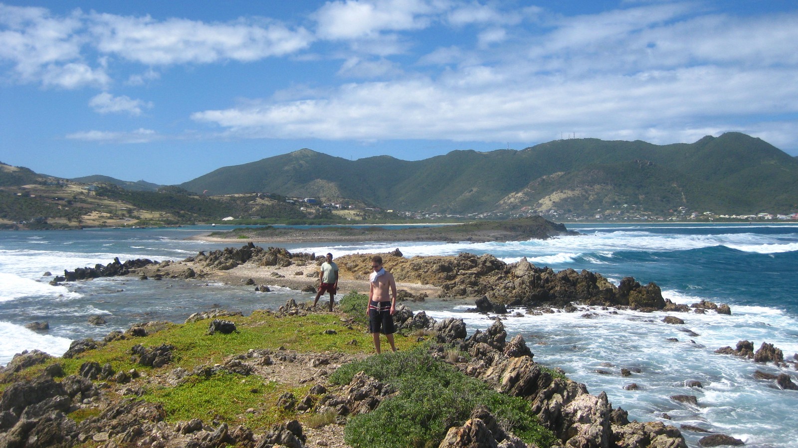
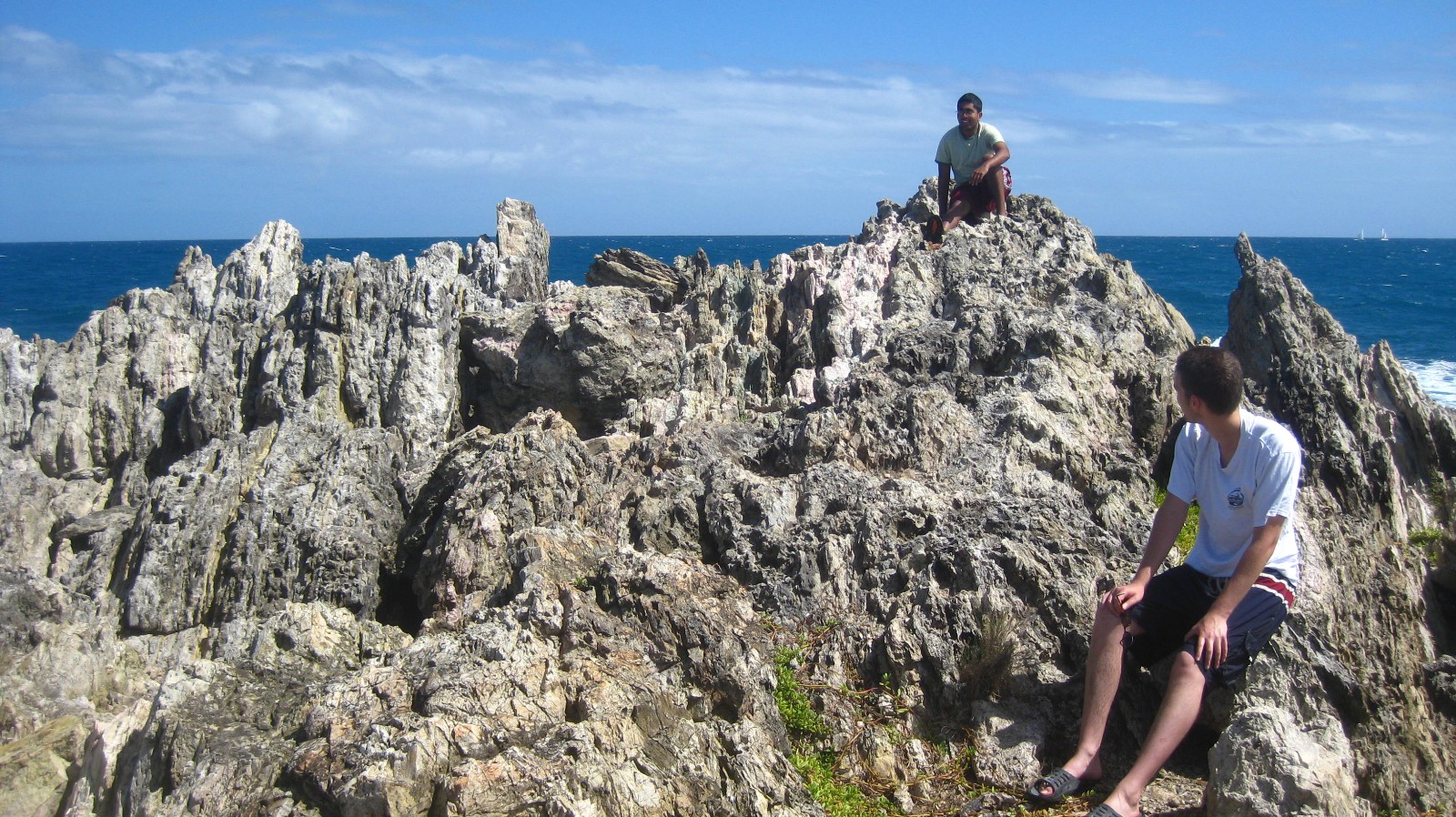
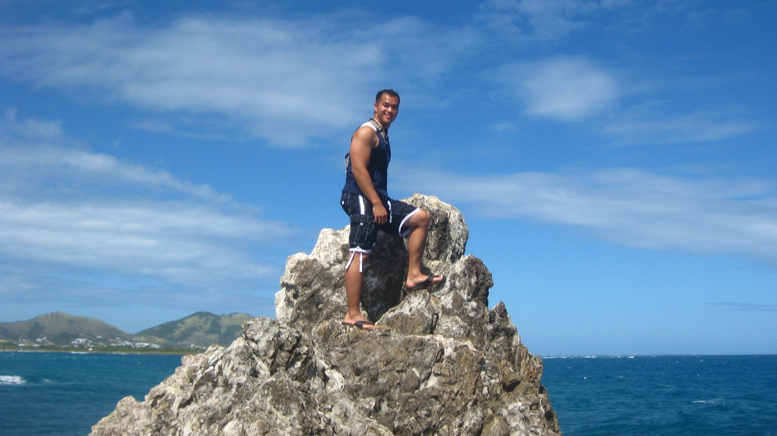
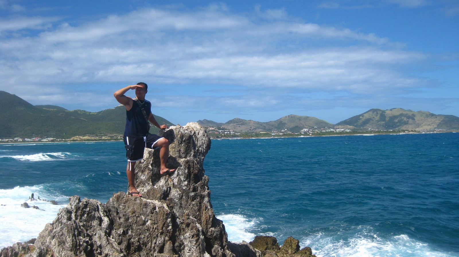
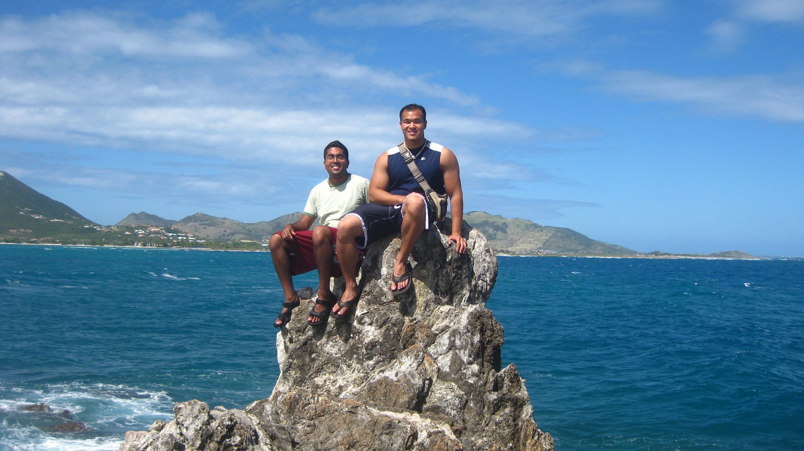
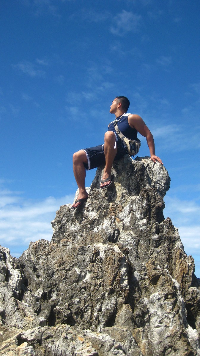
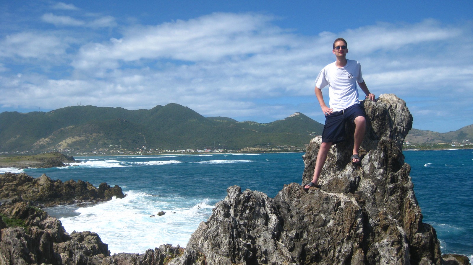
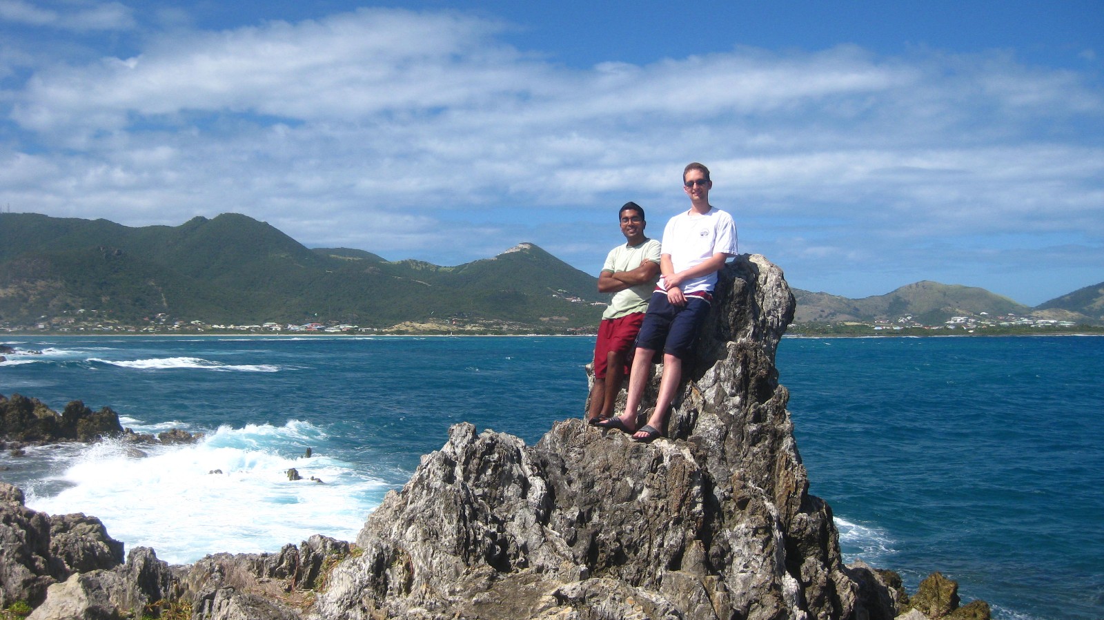
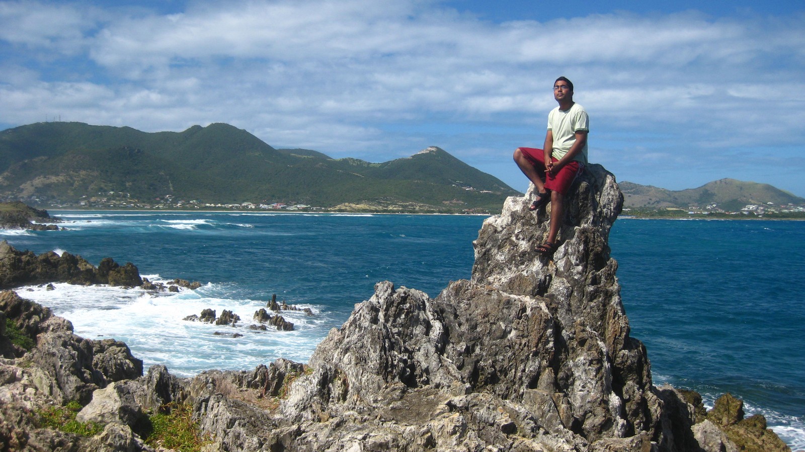
Once we reached the second island, we discovered an even more dry, and desolate graveyard of corals, along with jagged rocks jutting out like fingers crawling out of the sand, escaping from its distant volcanic past. For Caribbean islands surrounded by water, these islands seem awfully lifeless, barren, and desert-like. As we looked back at the first island we were at, then back at St. Martin where we parked, so smooth and green, we asked, how can an island be so close, but be such a worlds apart? While the second island has rocks jutting out of the sand, the third island IS a rock. As the islands get farther away from the mainland St. Martin, the harsher their landscapes become, and the path through the water that leads to them gets no less aggressive. The ground was uneven, with rocks spilled across the path. I was holding my camera pack high on my back, trying to keep it dry, but with the waves pushing and pulling against my legs on both sides, it was not easy. We noticed a lot of holes in the ground, and in them were these red dots. “What are those?,” Arif asked. Upon closer inspection, I realized we were stepping on a bed of fire. “Sea urchins!” I yelled. Although the path to the third island was the shortest we had to take, it took us the longest. We finally made it to the rock, but without ease. Chris and I got cut and scraped on our feet and legs. Arif managed to dodge them all. Oh well, I wanted souvenirs anyway. The third island rose like a tower from the waters. As we found a path to climb to the top, we looked out over the other two islands in front of us, and St. Martin in the background. It was a scene. We have reached an island off an island off an island off an island. We made it to the edge of the world and we felt like conquerors. Lessons learned:
- There’s more than just Tantra or Mullet Bay Beach on this island. Really go out and enjoy the island… there’s always something new to do here.
- Curiosity can drive you far. Never let anyone or anything get in the way of your curiosity, not sea urchins, not rocks, and certainly not the workload and challenges of med school.
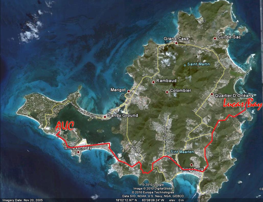


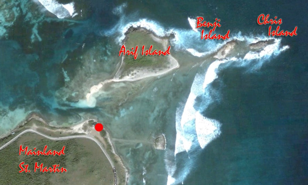

How to get to Lucas Bay from AUC:
View Larger Map